In October 2025, I planned to collect not one, but two high points in the Northeast. The concept was solid: Fly to Bangor, Maine, to meet E, my hiking buddy, then tackle Katahdin and Mount Washington back-to-back. We allowed a few days of flex time on each side—and a luxurious rest day in between—and thought ourselves wise.
As with many plans, however, reality did not follow the carefully planned and diagrammed agenda.
Let’s get into it.
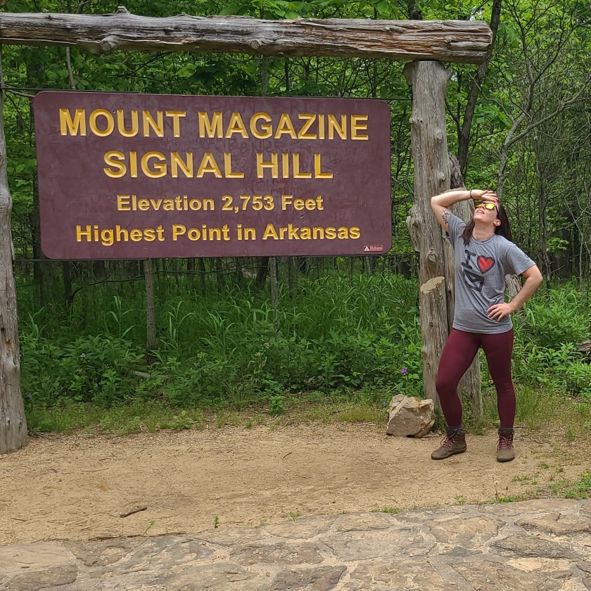
Part 1: Katahdin’s Baxter Peak
Things went sideways right from the jump. While both E and I had put a lot of time into preparing for our trip in terms of planning flights, stays, transportation, and equipment, it turned out that we’d forgotten the most important part of hiking Katahdin: A pass. I come from the Texas State Park system, which largely has a “come on down, y’all” approach to visitors. It didn’t even occur to me to check what the admissions requirements were for Katahdin, since it’s located in a state park.
Mistake number one. The day after we arrived in Maine, just 24 hours before we wanted to hike, one of us finally looked at the Baxter State Park website to figure out parking—and discovered that not only is admission limited, you have to book a pass months in advance in order to guarantee access to the park.
This is a notably bad thing to discover less than 24 hours before you intend to arrive at said park.
However, the kind ranger we spoke with let us know that they did have roughly a 25% no-show rate from folks who had booked a pass. They also had a hard cutoff entry time of 7am. These two facts together meant that a very limited number of passes would start to become available between 6 and 7 am.
There was just one problem: To do this, we’d need to arrive at the park (1.5 hours from our cabin), at 5:00 am.
Challenge: accepted.
The day of the hike
We woke up at 3:00 am, more full of determination than sleep. We hit the road in the dark, and drifted along black back roads through the Maine wilderness, not knowing what was waiting for us. Would we luck out and get inside the park? Or would we be turned away, and miss hiking the trail we’d come so far to conquer?
As much as the stress of the uncertainty boiled my stomach, I had to appreciate the system. The whole point is to safeguard a natural space that has been largely preserved from tourism and is allowed to be, for all intents and purposes, fully wild. It’s hard to resent gatekeeping when the cause is to preserve something wild and beautiful in an age of commodification.
We should have planned better, and there’s no way around that.
We got in line for the gate right at 5:00 AM. Bafflingly, we weren’t even the first people in line—two other cars had parked before us at the gate, lined up in a somber queue of sleepy hikers waiting to see if we’d beat the odds.
As light grew on us, and soft grey shadows lined the car, more cars filed in down the dirt road that led into the park. By the time we got to 6:00 AM, the line stretched down the small hill and around the bend, out of sight.
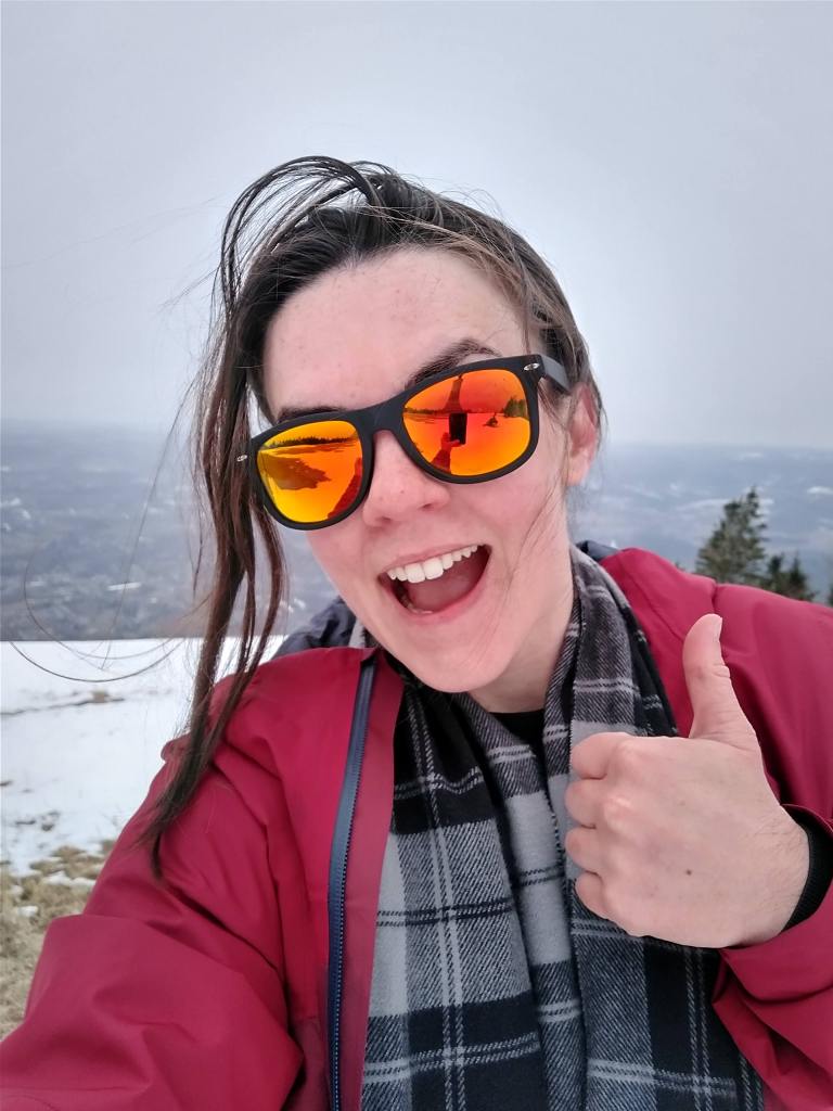
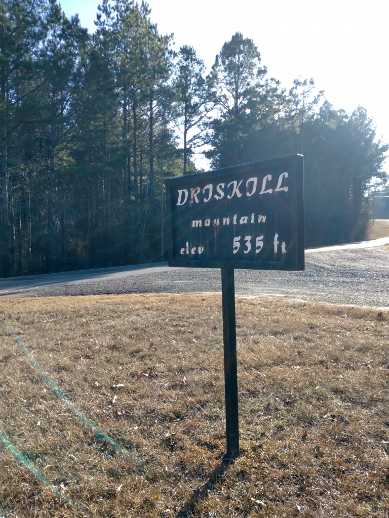
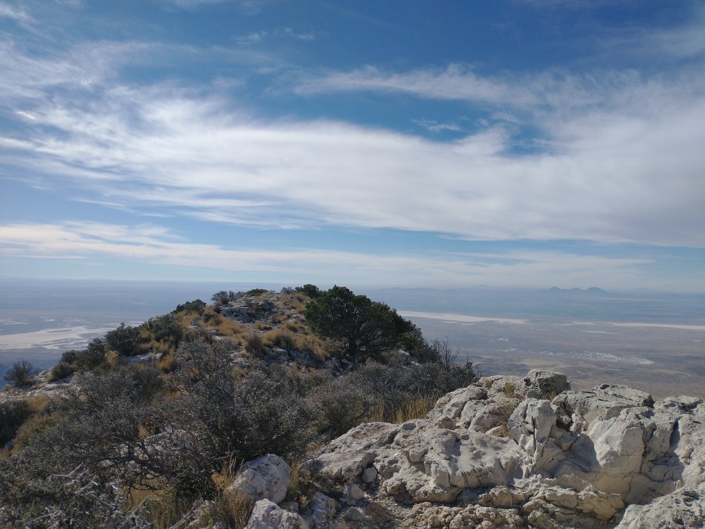
At this point, it was light enough to to see the object of all our desires, red and resplendent.
We got out of the car in the cold, and stretched our legs. Nearby, a couple shared oatmeal from a thermos, and chattered in heavy Canadian accents. My breath smoked in the cold, and I shivered with the cold tolerance of a sparrow. Yet I couldn’t take my eyes from that exquisite mountain, with her five peaks, cradling the dark valley.
Katahdin is beautiful, and that whole trip would have been worth it for that view alone.
Into that peaceful, anticipatory silence, suddenly a tremor ran through the waiting hikers. A ranger’s truck emerged from around the bend—and an older gentleman exited, and approached the first waiting car. The hikers sprawling across the grass hustled back to their cars, and we all held our breath.
As the third car in line, we didn’t have long to wait.
The ranger approached, and asked only if we already had a pass. When we said we didn’t, he checked his watch, made a mark on a clipboard, and waved us through.
Hardly believing our luck, we drove in near-silence down to the gatehouse, where we repeated this process. This time, the ranger there asked us a few more questions about whether we’d prepared properly, and whether we had enough water and flashlights. We paid our fee, collected some loaner headlamps—and just like that, we were through.
We’d made it into the park, and now: Katahdin waited for us.
The opening stretch
It’s at this point in the journey that I have to admit that I did something stupid. (Well, if you count the pass mishap, a second and additional something stupid.)
Two days prior, I’d spent a whole day traveling from Texas to Maine—which, between last-minute flight changes, delays, and layovers, took the better part of twelve hours. Not only was this stressful (I hate flying with a passion), but I tried to be cheap and mainline my way through on as little expensive airport refreshment as possible.
I arrived dehydrated, and promptly gave myself a UTI.
This fact will become relevant later.
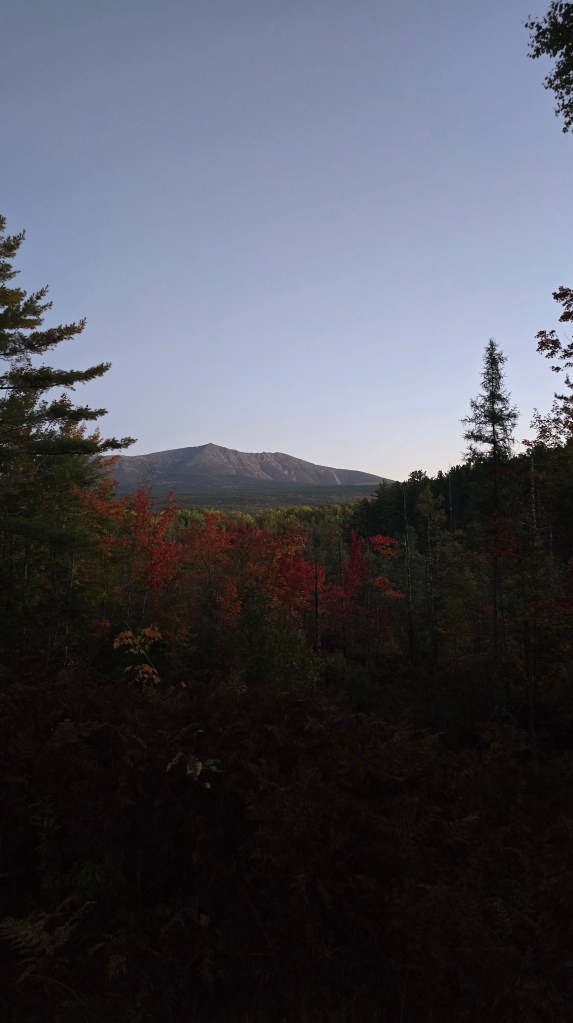
Entrance to the park secured, we cruised down the winding park road just as the sun began to filter through orange and red foliage. It felt like something out of movie, with a light wind blowing, and a single leaf falling from the trees above at a time. The road wound on ahead of us, curving gently, as the trees formed a tunnel overhead.
Finally, we reached our destination: The Hunt trail parking lot. Jackets on, boots tied, water bottles piled into packs at an alarming rate—and the bathroom visited a really astronomical number of times—we looked around for the ranger to check-in before our hike began. (We really are good at following directions most of the time. I promise.)
Again, it occurred to me how well the park’s management look after this place, and the people who visit it. They know the dangers of Baxter and Knife’s Edge, and the hazards of idiots from Texas hiking alone without proper gear or hydration. Every ranger we spoke with asked us about water, about our route, and made sure that we signed the log at the beginning of the trail to indicate our route and departure time.
Maybe this is true in other mountainous areas. I don’t remember it from doing Elbert, but that was ten years ago. I could be wrong.
Regardless, there’s a respect for nature (and what it can do to you) in the approach.
We signed the log, and began our ascent.
The opening to a symphony
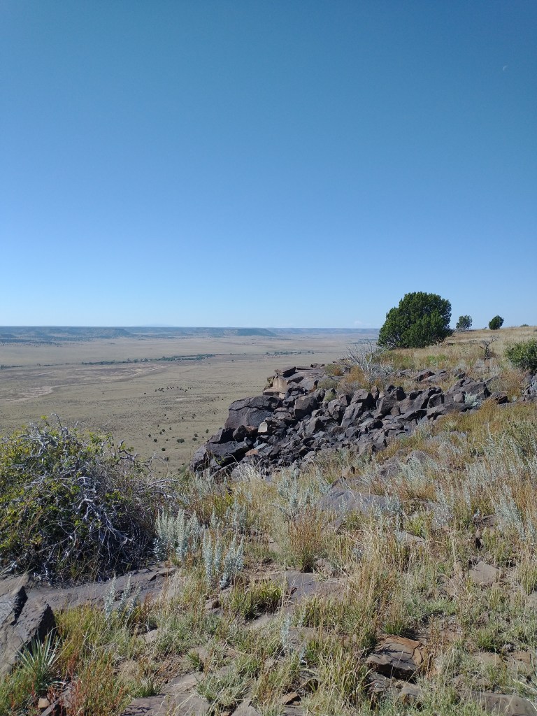
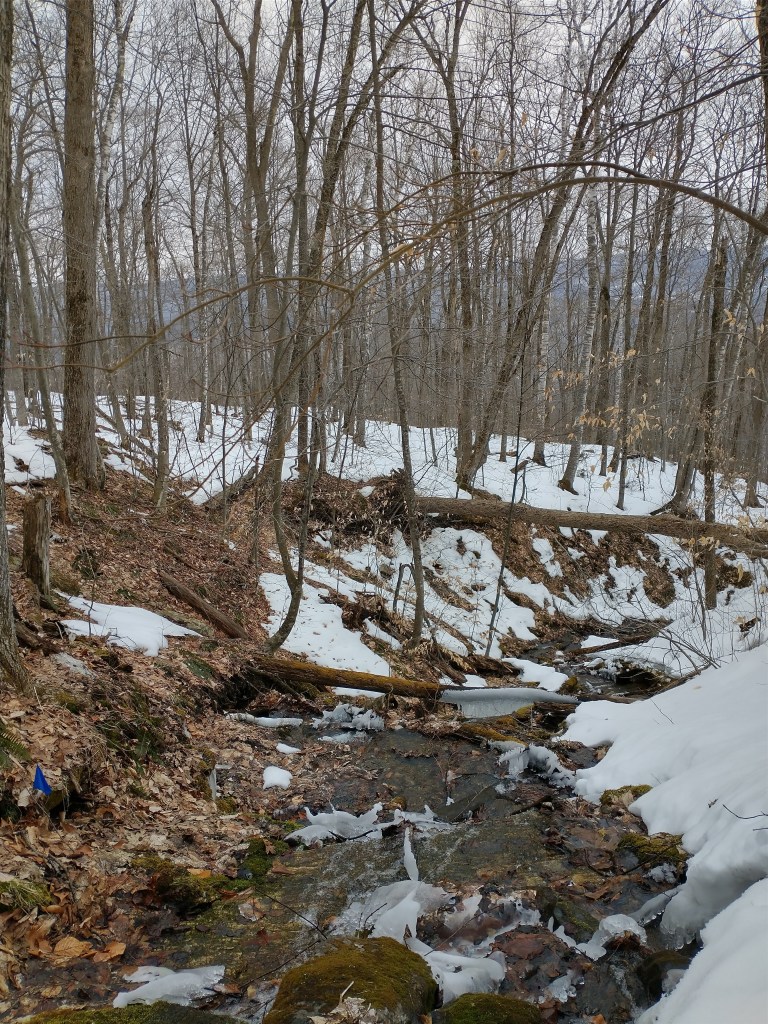
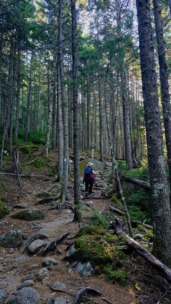
The Hunt trail to Baxter Peak begins with a deceptive smoothness. The first two miles or so are mostly flat, with sections of gentle incline that bely the difficulty of the second half of the climb, and wind past idyllic streams and waterfalls. With pine underfoot, and the day just breaking, it was a beautiful morning.
Isn’t that just giving elves on the road to the Grey Havens?
We didn’t stop much in the first few miles, eager to make it as far as possible before the appointed 12:00 PM stopping point. I say we didn’t stop much, because I definitely stopped about every 20 minutes to answer the call of the wild behind every opportune tree or boulder.
Don’t hike with a UTI. It sucks.
Still, sad bathroom habits aside, we made good time. Those first miles passed quickly, and the trail transitioned from a quiet forest path to larger and larger boulders, ranging from knee-high to fully the height of my torso. It made you appreciate the fact that the Appalachians are old, older than sin, older than bones, older even than the dinosaurs.
It was about this point that we started to see folks on their way to the top for the final stretch of their Appalachian Trail through hike. The Appalachian trail spans 2,197.9 miles, and if you start at Springer Mountain, in Georgia, the end of your journey is the summit of Katahdin. Despite differences in age, gender, race, and every other way in which humans can differ from one another—each one wore the same expression of relentless determination.
They passed us largely at incredible speeds, nearly jogging past with poles out, in a hurry to conquer the mountain and complete their herculean quest.
Feeling both a little awed and, for myself, a little outclassed, we cleared the trail for them each time, and plodded our way upwards much more slowly.
Separation point
After about four miles, the trail had begun to look less like a trail, and more like a bouldering route—at least for those of us with short legs. The boulders rose nearly shoulder-level now, and climbing upwards meant hauling ourselves up over each boulder in turn, rolling to your feet, and then repeating the procedure indefinitely until you looked backwards and realized you’d climbed 50 feet nearly straight upwards.
The trail, such as it was, existed mostly in white stripes painted on said boulders, leading towards a twisted blue opening in the tree line far above.
I didn’t take a lot of pictures of this section, mostly because I was spending most of my time either inchworming up boulders, or having punished-for-crimes-in-a-past-life pees behind increasingly sparse bushes.
Also, around this point, E tapped out. One of the things that makes her a great hiking buddy is that she knows her limits—and won’t endanger herself or us as a unit by pushing past that point. There’s challenging yourself, and there’s posing a danger to yourself and others. I appreciate that she stays on the safe side of that line.
So, E flagged that she didn’t expect to summit, but would continue noodling upwards until noon.
I, on the other hand, now had permission to go at my own pace and try to summit by myself. With about 30% of the trail to the top left—and Katahdin sitting at only 5,269 ft above sea level—this felt like a reasonable choice.
With the sun not even midway across the sky, and not a cloud in sight, soloing the rest and meeting up halfway down again should have been very doable. Or at least, so I thought, in my hubris.
The mountain, however, had other ideas.
The Gateway
Alone now, I scrambled up boulders higher than my head, all tumbled over each other in haphazard fashion. The number of hikers passing us on their route up had severely lessened, and I would go 15-20 minutes without seeing a person, maybe more.
(This was perhaps for the best, as the pee breaks continued.)
According to the AllTrails map on my phone, the next big marker on the trail was something called The Gateway, after which the trail was supposed to flatten out. The route appeared to have most of the elevation in the middle part of the hike, with the last two miles being a sort of tableland, gently sloping up to the peak. The Gateway, whatever that was, would mark the end of the steep vertical section.
For about 10 minutes, I checked my phone every time I made a turn, as the trail got increasingly difficult to make out from boulder to boulder, and none of the rock configurations seemed to clearly indicate a “gateway” of any sort.
Finally, the trail reached a fork. On the one side, a small trail ran into the bushes, appearing to route around a very large white boulder. (I could reach the top, but just barely.) On the other, a path appeared to be shaped entirely of boulder, with two big ones forming a sort of opening up which one could halfway vault and/or wriggle up.
Helpfully, my phone map GPS spun in a circle and could in no way indicate which way was the correct way.
I took both. The path around seemed to lead nowhere, so after trying that, I gamely scrambled up the boulder, up another extremely similar boulder, turned a corner—and abruptly broke out above the tree line.
The wind whipped here, and the drop down from the boulder I stood on was suddenly quite sharp.
I hunched down on all fours, and squinted to make sure I wasn’t about to do something stupid. The sudden danger made me think that maybe I had taken the wrong turn below, and was somehow off-trail.
But no, there it was: the white painted stripes, just ahead of me, indicating the trail proceeded up and to the right.
More specifically, the trail proceeded straight up.
I cannot overstate this. The trail went from a dirt path winding upwards on a sharp incline, to a route that wouldn’t have been out of place in a bouldering gym. Sheer faces of pale rock wound up at a sharp vertical. Iron bars, hewn into the stone as handholds to pull one’s self over the most unforgiving stretches of completely vertical rock, stuck out at rare intervals. One section appeared to require shimmying in a plume, supporting your weight with tension between your back and your feet.
I made a few circles around the area to make sure I wasn’t losing my mind. The map arrow spun around a few more times, but seemed fairly certain this was the trail. And there was that white Gatsbian stripe overhead, teasing the way.
No, no, that was correct. The way forward was simply to climb straight up the vertical boulders.
I sat down in the most sheltered crevice I could find, and sighed.
With my back to a boulder, I looked out over the treetops; the vast expanse of space below. The wind caught my hat, pulled my hair in its two heavy braids, tugged at the corners of my jacket. The abundance of water bottles in my pack tugged me down, into the stone.
I gazed out over the sudden valley, and for the first time, it occurred to me that I had selected an unfortunate hobby for someone who hates heights.

The idea of ascending that steep drop alone, without rope, water pulling me down with every tenuous hold, filled me with dread. Nothing I’d read said we’d need equipment. The trail was specifically marked as “strenuous”, but didn’t specify equipment or bouldering. AllTrails had it listed as “technical boulder scrambling” that required both hands and feet.
Now, I am not above Gollum impressions from time to time. But this was beyond my expectations.
I checked the map again.
I remained in the correct position.
I really, really needed to pee again.
I made a small circle around the ascent, getting as close to the double column of boulders as possible without leaving the ground. I hoped that an easier way of ascending would present itself, one that did not involve me shimmying up a rock in the wind, while my pack tried to pull me back down (and off the face of the mountain itself).
None presented itself.
The route was up, and that was that.
I sat down on the rocks again, and faced the facts: I was outclassed.
I absolutely was not prepared for this, and would have to turn around.
I could not summit Katahdin.
The slow march of the defeated
I stumbled back down the trail, numb with disbelief—and a little bit of shock.
Mount Elbert in Colorado wasn’t like this.
Guadalupe Peak in Texas, at 8,751 feet, wasn’t like this.
This was a 5,269-foot peak, tucked away in the furthest corner of the Appalachians. I’d expected this to be a relaxing, low-effort summit. A quick day hike with a pleasant summit before noon. This wasn’t even the Rockies, for crying out loud.
I felt humbled. Stunned. I’d underestimated the Appalachians severely, which is a thing you read about and go, “Surely that doesn’t apply to me.” Spoiler: It does, and it did! In that moment, I was just a stupid Southerner out of their element, after all.
The realization stung—but not as much as the trip I made behind the bushes as soon as there were bushes to go behind.
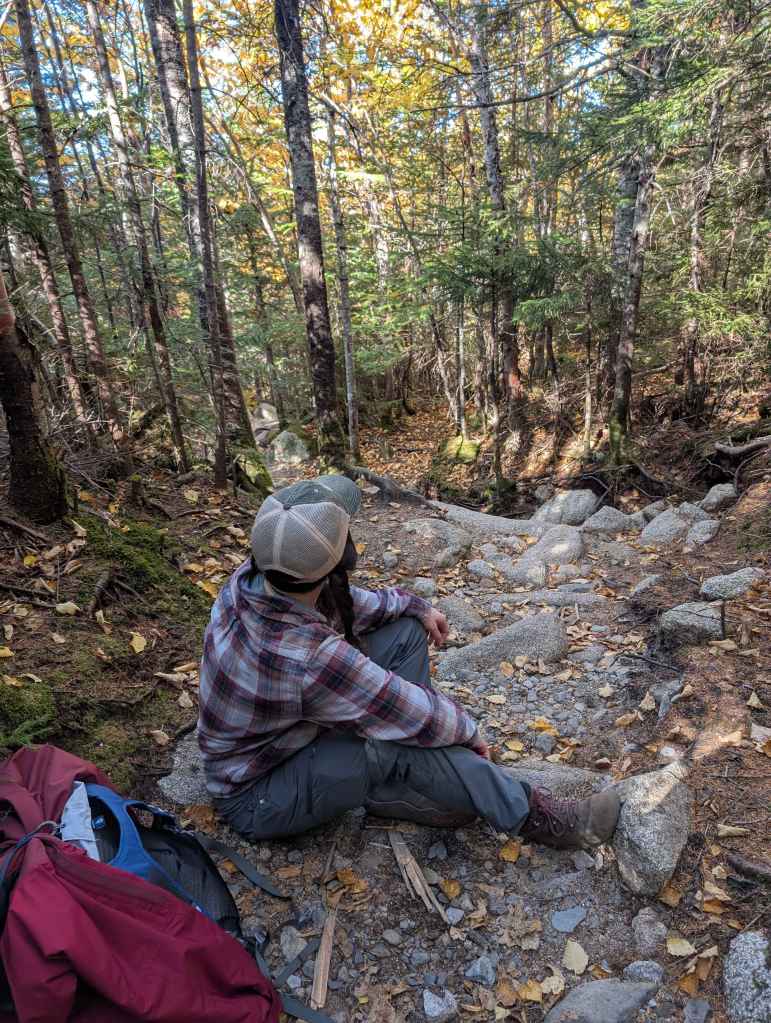
In about twenty minutes, I ran into E again, doggedly climbing her way upwards still, and relayed the situation. We held a brief strategy meeting based on my findings below the Gateway, and elected to call our ascent short together.
We began the slow march back to the car.
The descent passed in a blur. Without the pressure to get to the top by a particular time, we slowed our natural pace some, with more time to pause by rushing streams and admire the pine trees above our heads. The birds sang, and the sun warmed our shoulders at every break in the trees.
As the hours passed, and the mountain dropped slowly into valley underfoot, I thought about that moment on the side of Katahdin.
It didn’t feel like a failure, in many ways, so much as a moment of brutal honesty. I simply could not do the thing in front of me, alone and unequipped. I’d run into a brick wall, and had to be truthful about the experience. It felt inarguable, like cutting a hike short because of weather or a medical emergency. I didn’t have the tools—and no amount of willpower was going to change that.
And maybe the “tools” I needed was just more experience, not a carabiner. Maybe I’d guessed wrong, at the top. Either way, I didn’t have what I needed.
I felt chastened—and a little awed.
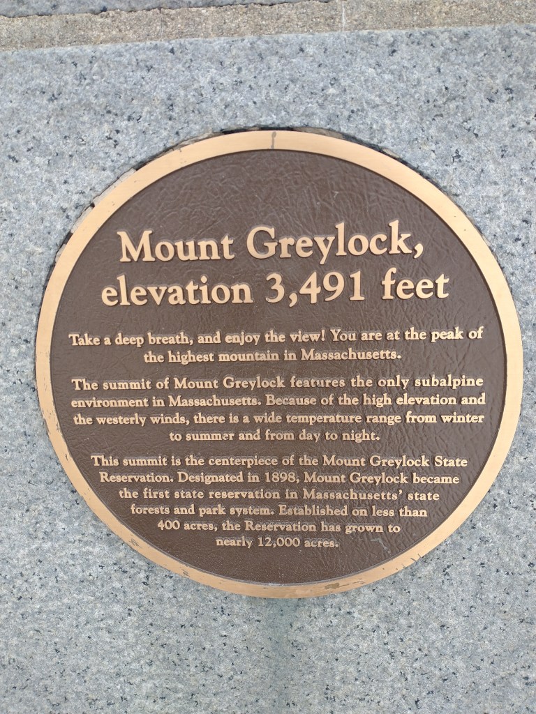
The Penobscot people who once lived on that land called Katahdin “The Greatest Mountain,” and held the place sacred. The governor who bought the land later set aside a trust for it to ensure that Baxter State Park always remained wild and preserved. Both had looked at this place and felt something large and reverential.
On that long trek back, I understood. Katahdin humbles you.
In conclusion
When we made it back to the car around 4, E and I reviewed our options on the way to Food, Any Food, absolutely Any Food At All. Ten miles of hiking, dropping temperatures, and one UTI that needed an antibiotic sooner rather than later, all added up to one pretty inarguable conclusion.
We were definitely driving up Mount Washington.
Part 2: Mount Washington
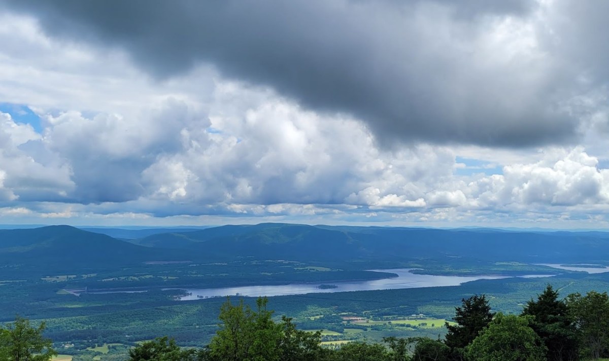
48 hours and one telehealth visit later; we arrived at the foot of Mount Washington around noon. The sun shone, the sky was blue, and White Mountain National Forest teemed with visitors in the way that a carcass teems with scavenger beetles.
There really couldn’t be a more polar opposite experience, I reflected, as we wound our rental car through the parking lot towards the summit road.
Where Katahdin threw obstacle after obstacle at us—with the park system itself discouraging all but the most determined visitors—Mount Washington practically screamed for attention. Large signs marked our entrance to the park, and advertised the drivability of the peak for all to see. The summit road was clearly marked, and included a toll booth to collect the $65 necessary for two adults and one car to utilize the road. If you didn’t want to drive yourself, you could also pay to ride in a van driven by park staff, for $55.
And finally, in a crowning absurdity, there was a gift shop both at the bottom and, we would later learn, also at the top of the mountain.
The drive upwards
I can’t take credit for driving to the 6,289 ft summit of Mount Washington, which for a person with pretty severe fear of heights, would have been a feat. (I drove skyline drive in Colorado by myself a few years ago purely recreationally, and there are few experiences I regretted more immediately.) But E had rented the car, and so assumed the responsibility of piloting us safely towards the heavens.
My job was to hold tightly to the car’s interior, and curse at every sharp turn.
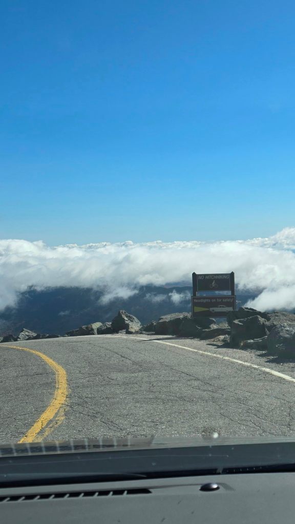
The only saving grace, I think, of the drive up Mount Washington, is that it’s so foggy that you often can’t see the drop on either side of the road you’re on. It’s like driving through a middle-school dance floor, sans the Flo Rida, and with a little extra vertigo when the valley floor becomes visible.
I again had the thought: Why have I, a person who does not enjoy heights, chosen to high point?
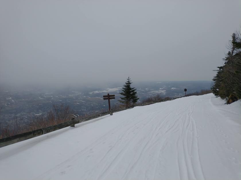
It took about twenty-five minutes to make the ascent through the clouds, accounting for a few pauses to pull over and take pictures at overlooks. The sky was overcast for most of the drive up, however, so we didn’t stay too long at any stop. Also, if we finish the drive, that’s less time for me to second-guess my participation!
Finally, we reached the top—and were immediately confronted with civilization in the shape of a very well-organized parking lot and train station.
Dutifully, we parked.
The summit
The top of Mount Washington is surprisingly hospitable, for a place that holds the record for the highest wind speed ever measured on land—231 mph. There’s an observatory, indoor plumbing, a train station, and, most notably, a large gift shop. You can stand behind glass and drink hot cocoa while browsing a selection of t-shirts with various facts about how dangerous the mountain you’re standing on is.
It’s a little weird.
On the opposite wall, you can also read the giant poster listing the number of recorded deaths on Mount Washington, including the name, age, and manner of death. There are 164 as of the time we visited, with the most recent being just a few weeks prior. Most of the recent deaths were due to foolish last-minute decisions, where folks rode the train up and then wandered off onto a trail near the summit more dangerous than they anticipated.
Somewhat sobered by this, we climbed the last set of stairs up to the rocks that marked the summit of Mount Washington, and stood there surrounded by clouds.
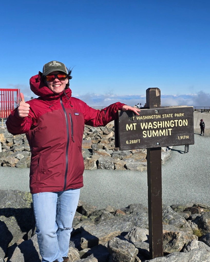
The mountain is known for it’s record-breaking weather, and while we were there it reached 18 degrees with the wind chill. For all the experience was much more modernized than Katahdin, I felt grateful for the modern amenities. I couldn’t imagine being one of the through-hikers seeking shelter in the back of the building, resting on their way through to complete the Appalachian trail.
And that, too, was a strange feeling. I’ve always wanted to hike the AT. But the feeling of being just utterly defeated on the side of Katahdin a few days prior was still fresh, and I felt only the utmost respect for those hikers. They’re doing something extraordinary, that requires more resources, training, physical resilience, and commitment than simply the ability to take six months off work.
I felt, again, chastened, as we returned to the car. I was glad we hadn’t tried to hike even a little on Mount Washington. I’d seen the list of deaths. I had just come up short against my own limits. I was, simply put, not ready for that kind of undertaking.
There’s only so far stubborn determination and a love of the outdoors can take a Southerner, and I knew when I’d met my match.
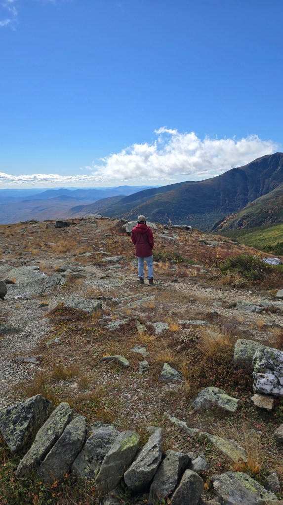
On our way down, we stopped at a pullover, and hiked a few minutes on a short trail overlooking the valley. The wind bit, sharp and cold after the car’s warmth, and I raised my face to the sun.
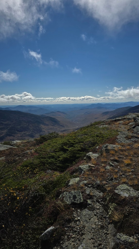
It felt good to be safe, and humbled, and alive. Defeated, maybe—but also not dead on the side of the mountain somewhere, with a name to add to the morbid list in the gift shop. Know your limits.
After admiring the view and the many mountain cairns until our fingers began to numb, we piled back into the car and called ourselves successful. Mountain = ascended. After the trials of the last few days, it no longer felt as important to have climbed it ourselves, top to bottom, as it did to have survived the experience.
Safe, content, and a bit smaller in the britches, we drove down Mount Washington in a companionable silence. Overhead, sunlight shifted through stripes of fog, and lit our path by turns. By the time we reached the foot, the sun shone so brightly overhead that you could hardly imagine that just a few hundred feet above, you’d sit among the clouds.
Two highpoints both alike in dignity
On our drive back to our New Hampshire Airbnb, I thought about the differences between these two high point experiences; the contrast winding them together inextricably.
- Katahdin: Harsh, inhospitable, inaccessible. Protected by the people who love that land, and guard its treasures with no regard for commercial interests.
- Mount Washington: Welcoming, but dangerous. The reality of the mountain’s elements is touted for novelty, but masked by modern conveniences and development.
If you’re an experienced hiker armed to the teeth with equipment and raw dogging each summit without taking advantage of the resources Mount Washington offers, Mount Washington is more difficult. But if you’re stumbling your way through each experience, Katahdin is by far more inhospitable. The sheer drops. The harsh winds. The isolation from civilization, the pilgrimage you make to reach it.
And yet, it’s Katahdin that beckons. I have no urge to return to the comfortable warmth of the Mount Washington gift shop. But long after this trip fades to memory and journal entries, it’s Katahdin that I will return to.
Reflections
In the end, this trip provided some perspective on my high pointing journey. As I sit at home in Austin, Texas, and write down the story of these two summit attempts together, I think of all the peaks still to come on my list. There’s King’s Peak in Utah, at 13,528 ft. Or Wyoming’s Gannett Peak, another 13,000-footer reachable only via three-day hike. Not to mention Denali, the tallest peak on the continent.
And I struggled at 5,000 feet.
It’s difficult to admit, as a person who’s been outdoorsy my whole life, but I’m not ready for those big peaks, not even close. I’m from the south, and day hikes on Enchanted Rock and through Dinosaur Valley won’t prepare you for a 14,000-foot summit. I need to prepare myself before embarking on these more challenging peaks, whether that looks like mountaineering courses, multi-day thru hikes, or even just acclimating to hiking at altitudes.
I can’t just roll out of bed (or out from behind my 9-5 desk) and do these things.
That knowledge is humbling, and that feels good. Like touching snow with your bare hands, it’s clear and cold and unforgiving. I’m not ready. There’s work to be done—and it’s good to have an honest answer about my limits and capabilities.
In many ways, now I’m simply grateful for the test. I have the body and the resources to see how much a mountain can demand of a person. There is a deep joy, I think, to be found in failure, of dipping a toe into a puddle and finding it a lake… or an ocean.
To learn, so suddenly, how much more there is to learn, to know, to do, to become.